MarineOS
Helm display · iPhone · iPad · Cloud

One MarineOS.
Every screen on board.

Charts, navigation, engines and alarms at the helm. The same boat on your iPhone and iPad. Routes you plan at home, already on board. MarineOS is the marine platform under all of it.

The chart is free to use in your browser, no account needed.

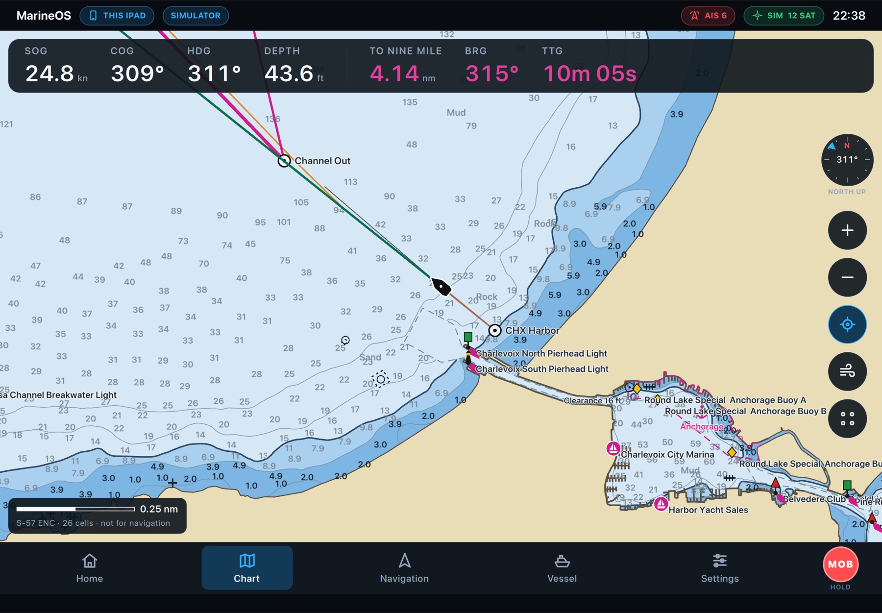
The MarineOS helm display: a NOAA chart with soundings, aids to navigation, the boat's route and the instrument bar
MarineOS
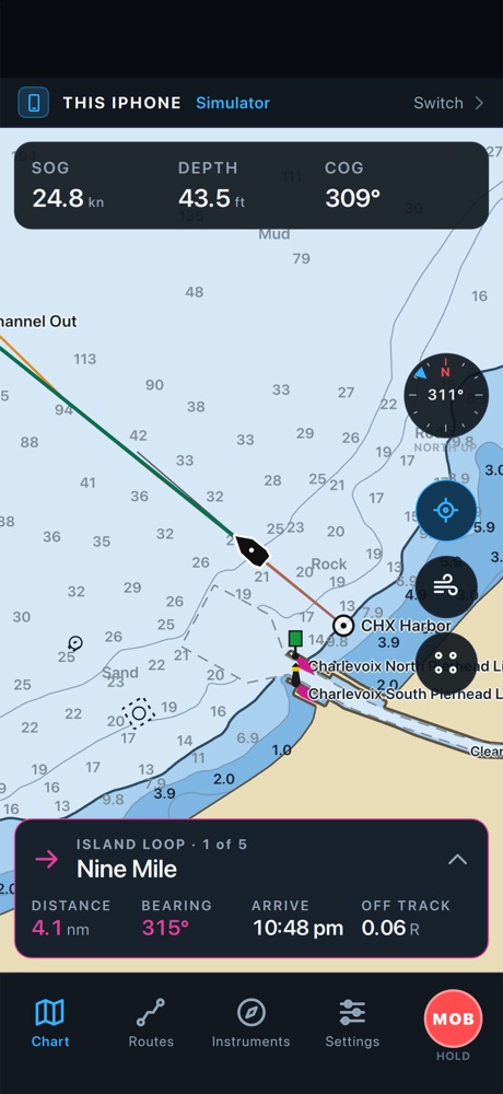
MarineOS on an iPhone: soundings, the route and the next mark, Nine Mile

NOAA ENC · USACE inland charts · Michigan DNR lake depths · OpenStreetMap places

One platform

Not another charting app. The system your boat runs on.

One MarineOS runs the display at the helm, the app on your phone and tablet, and the Cloud in your browser. Same charts, same routes, same boat, wherever you are.

Helm display

A chartplotter and instrument display on a Raspberry Pi panel: NMEA 2000 and 0183, charts on board, no signal needed.

iPhone

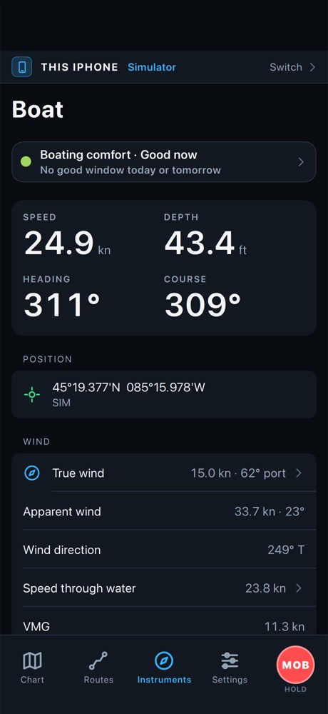
Your own chartplotter in your pocket, or your boat from anywhere: position, readings, alarms and anchor watch.

iPad & Mac

The full helm experience on a bigger screen: charts, routes, Auto Guidance and the boat's data, at the table or the nav station.

MarineOS Cloud

Plan routes in the browser, watch your boats live, keep every waypoint and track in sync, and update your displays.

Your day on the water

Plan it. Run it. Watch it. Keep it.

From the kitchen table to the helm and back, MarineOS carries everything with you.

1
Plan at home

Plan the passage from your couch.

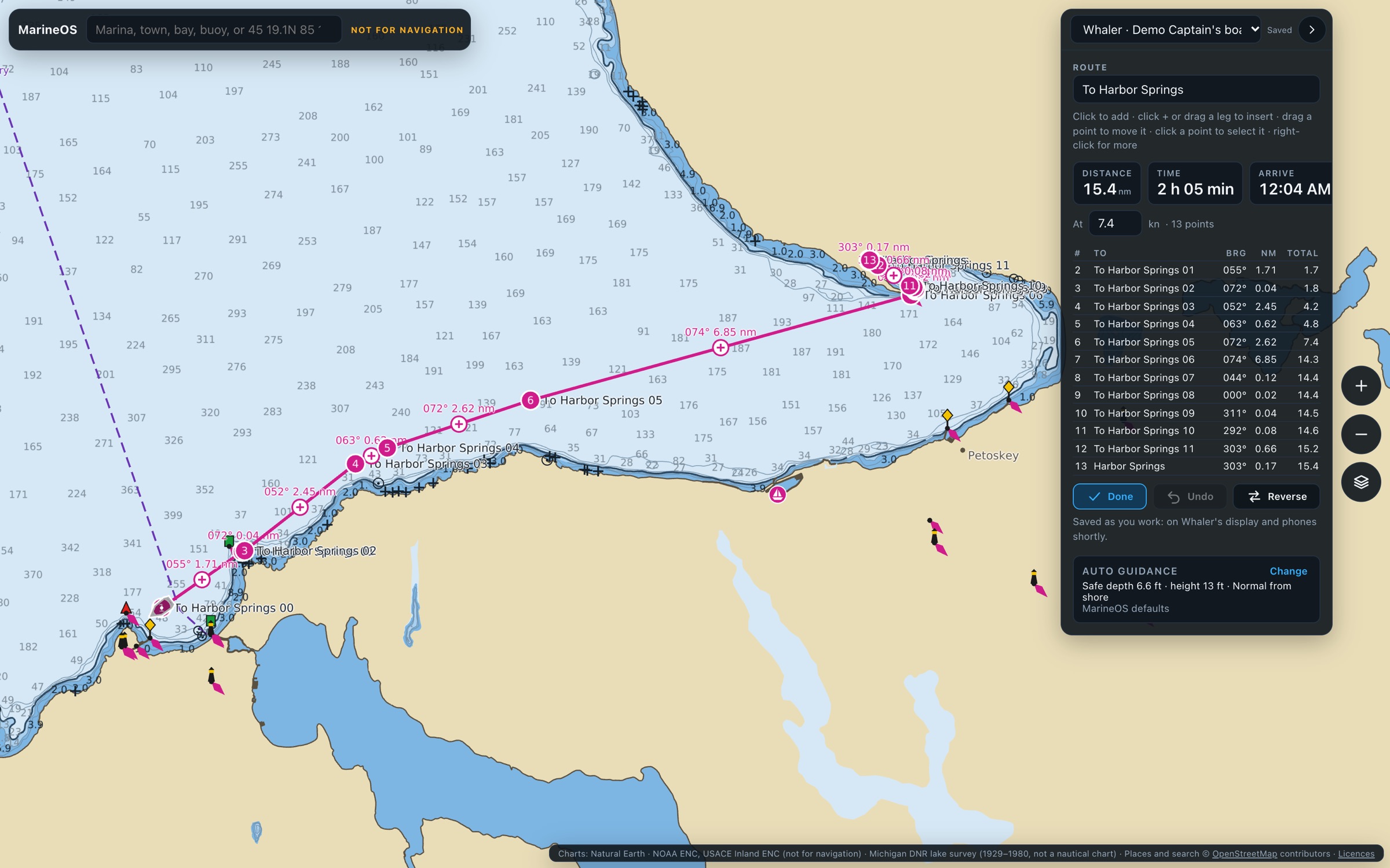
Open MarineOS Cloud in any browser. Click the chart for each mark, or let Auto Guidance find the way: it plans around land, shallows and low bridges using your boat's own draft and clearance, and gives you distance, time and arrival for every leg.

  • Auto Guidance with your boat's settings
  • Drag points, insert legs, undo
  • Routes and waypoints saved as you work
marineos.cloud/chart
Planning a route to Harbor Springs in MarineOS Cloud
2
Navigate on board

It's already at the helm.

The route you planned is on the helm display when you step aboard. NOAA charts, your position and course, the next mark, AIS traffic and alarms: everything a skipper needs at a glance, on a display that works with no signal at all.

  • NOAA ENC and inland charts on board
  • Distance, bearing and time to the next mark
  • AIS, collision, shallow-water and off-course alarms
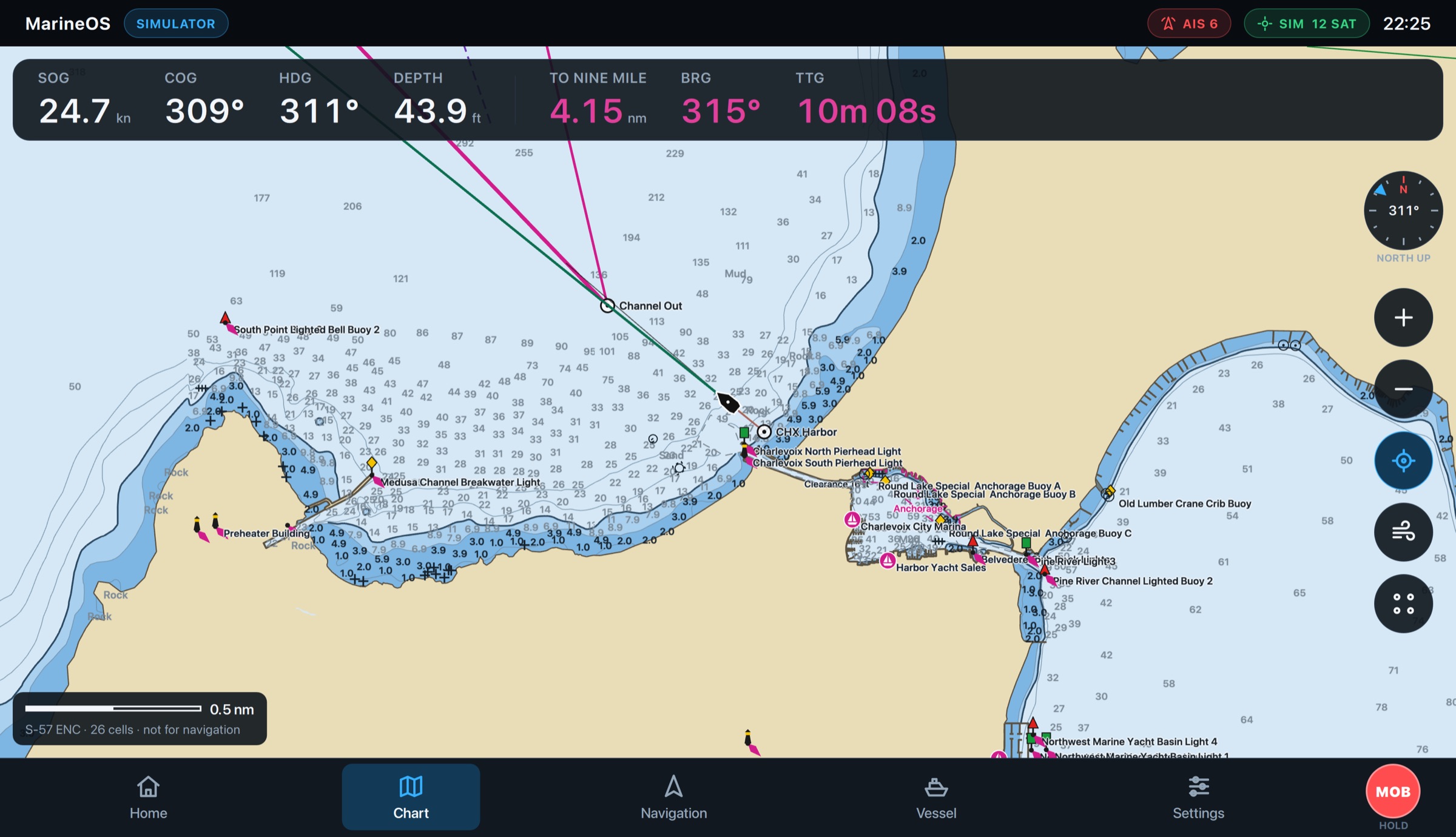
The MarineOS helm display navigating the Island Loop
MarineOS
3
Watch from anywhere

Your boat, in your pocket.

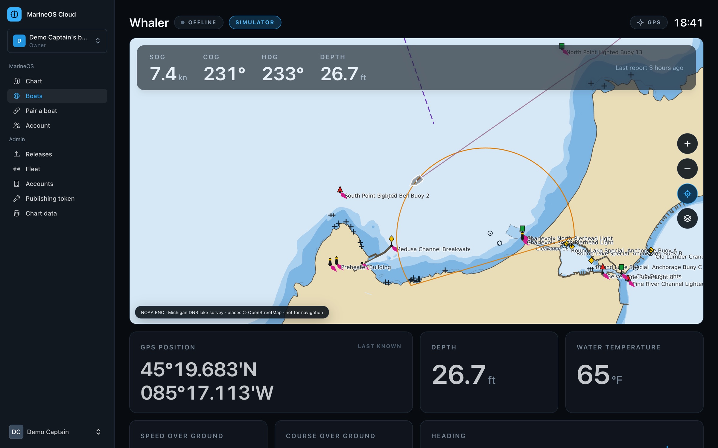
At the dock or across the country, MarineOS shows where your boat is and how it's doing: speed, depth, engines, battery, alarms and anchor watch, live on your iPhone and in the Cloud. And a forecast that tells you when it's good to go.

  • Live position, readings and alarms
  • Anchor watch from shore
  • Boating comfort from the weather forecast
marineos.cloud/boats
A boat's page in MarineOS Cloud: its instruments over the chart
A boat's readings, wind and boating comfort on an iPhone
4
Know your boat

Engines, fuel and power, understood.

Engine RPM, coolant and oil pressure, hours on each engine, fuel burn, economy and range, battery and charging, and a trip log of every outing. MarineOS reads your boat's NMEA 2000 network and shows it all in one place.

  • Twin engines, hours and temperatures
  • Fuel economy and range as you go
  • Maintenance from engine hours: coming soon
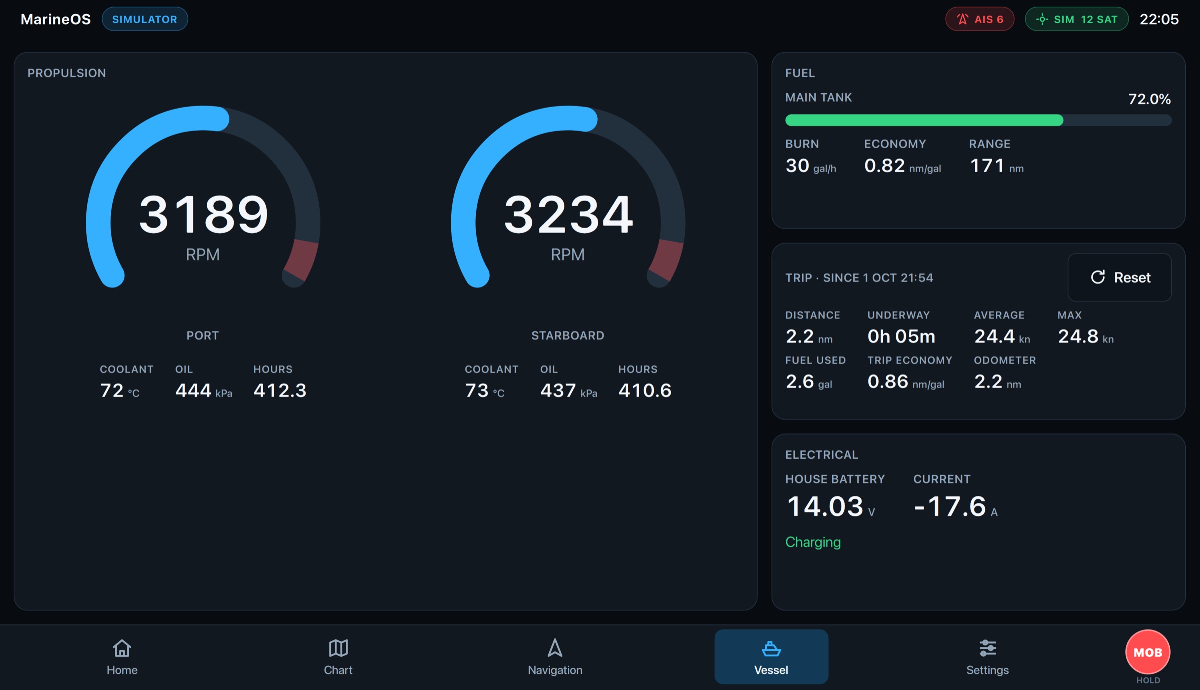
Engines, fuel, trip and electrical on the MarineOS helm display
MarineOS
5
Always in sync

Change it anywhere. It's everywhere.

Routes, waypoints and tracks follow you between the helm, your phone, your tablet and the Cloud. Edit a route on the iPad and the helm display has it in moments; mark a fishing spot at sea and it's in your browser at home.

  • Routes, waypoints and tracks in sync
  • Works offline, catches up when connected
  • GPX in and out
MarineOS on an iPad: the same chart, soundings and route as the helm
Traffic & alarms

See them coming.

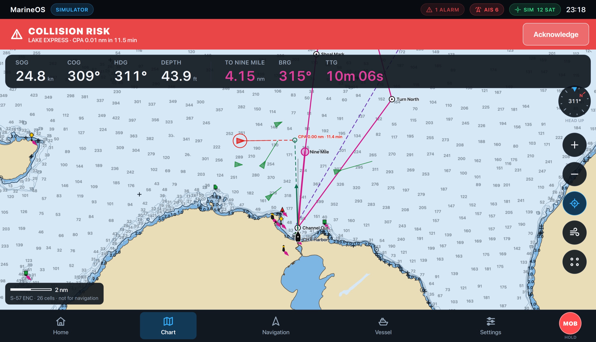
Every AIS target on the chart with its course, and MarineOS working out how close each will pass and when. When a ship is on a collision course, the helm turns red, tells you who, how close and how soon, and shows on the chart where you'll meet.

  • AIS targets, and where and when each passes closest
  • Collision, shallow water, off course and arrival alarms
  • Anchor drag, low fuel, battery and engine temperature alarms
  • Man overboard: one press marks the spot and guides you back
A collision alert on the MarineOS helm display: LAKE EXPRESS ringed in red, both tracks drawn to the point of closest approach, 11 minutes ahead
MarineOS
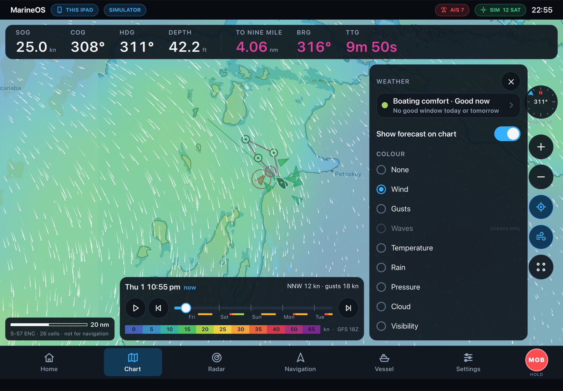
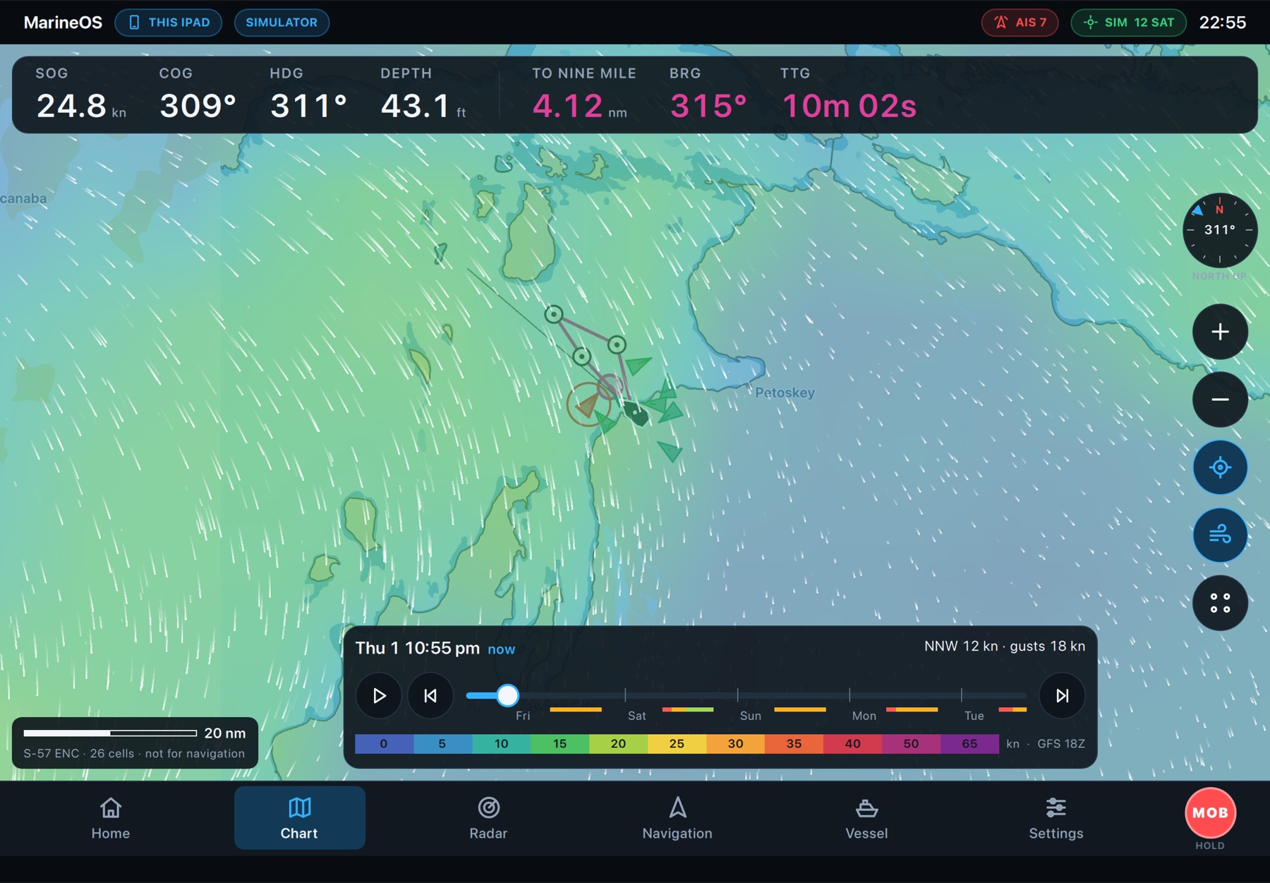
The wind forecast over the chart on an iPad: colours by wind speed, flowing wind lines and a timeline to play it forward
Weather on the chart

Know what the wind's doing before you go.

Download NOAA's forecast for where you're boating, then play it forward right on the chart: wind, gusts, waves, rain, pressure, cloud and visibility, hour by hour, offline once it's on board. And a boating comfort rating that finds the good window for you.

  • NOAA GFS forecasts, 16 days ahead
  • Wind, gusts, waves, rain, pressure, cloud, visibility
  • Boating comfort: when it's good to go
  • National Weather Service marine forecasts and warnings
Radar
Coming soon

Radar, on its own or over the chart.

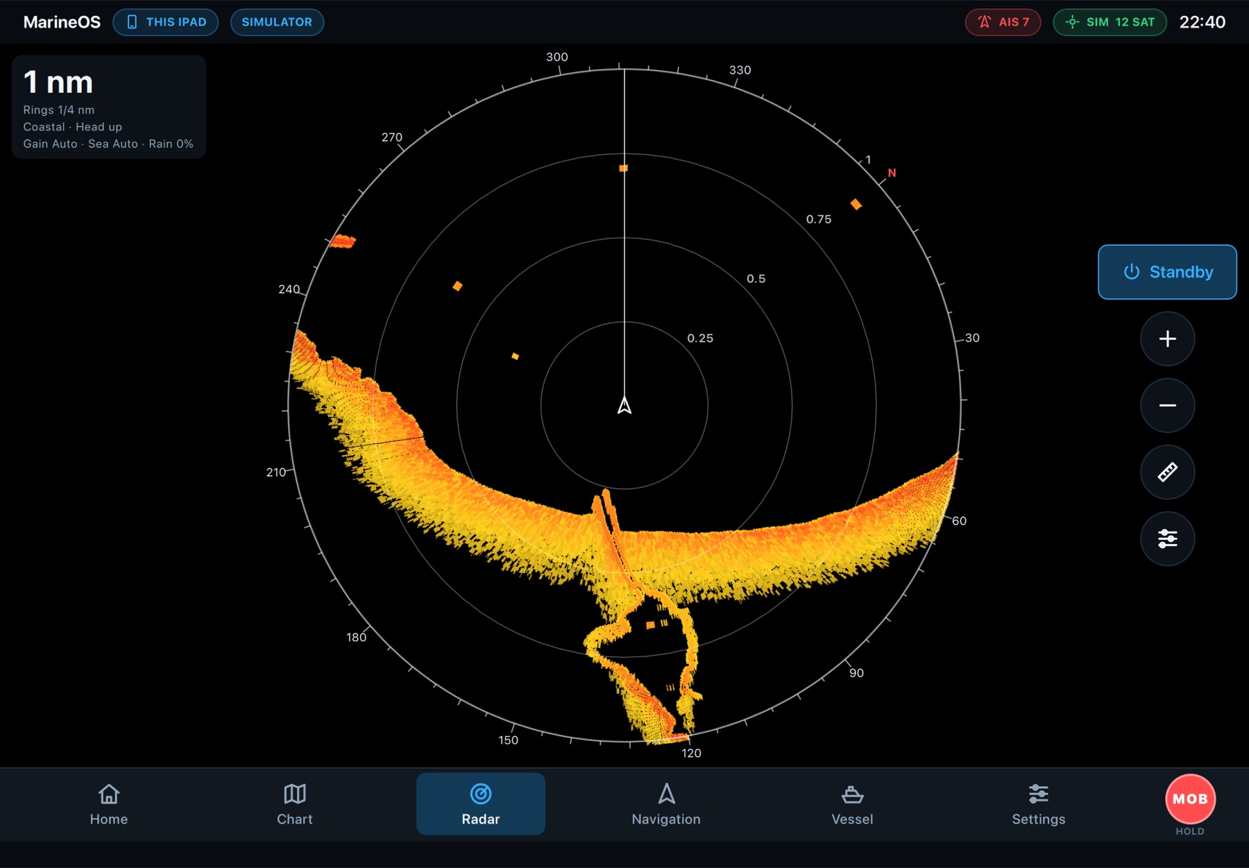
A full radar screen with range, gain, sea and rain, and the same picture laid over the chart so land, buoys and boats line up with the returns. Shown here with MarineOS's radar simulator; support for Garmin, Furuno, Raymarine and Navico scanners is on the way.

The MarineOS radar screen on an iPad: the shoreline and harbour piers at one nautical mile
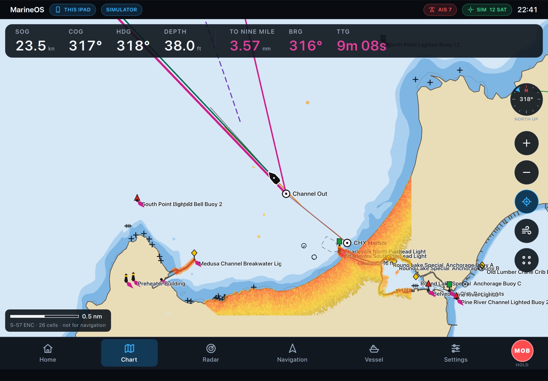
Radar over the chart on an iPad: the returns line up with the shore, the piers and the harbour
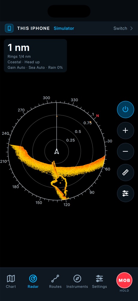
The radar on an iPhone
What's on board

Everything at the helm, designed for the helm.

Big numbers you can read in sun and spray, red night mode for after dark, and controls sized for a moving boat.

Nautical charts

NOAA ENC and USACE inland charts, Michigan DNR lake depths, kept up to date.

Auto Guidance

A route around land, shallows and low bridges, by your boat's draft and clearance.

Routes & waypoints

Draw, drag and edit on the chart. Guide to any mark with distance, bearing and time.

AIS & alarms

Traffic with closest approach, plus shallow, off-course, arrival and engine alarms.

Weather & comfort

Wind and waves, and a boating comfort forecast that finds your window.

Engines & fuel

RPM, temperatures, oil, hours, fuel burn, economy and range from NMEA 2000.

Anchor watch

A swing circle and an alarm, on board and on your phone ashore.

Places ashore

Marinas, fuel docks, ramps and restaurants from OpenStreetMap, on the chart.

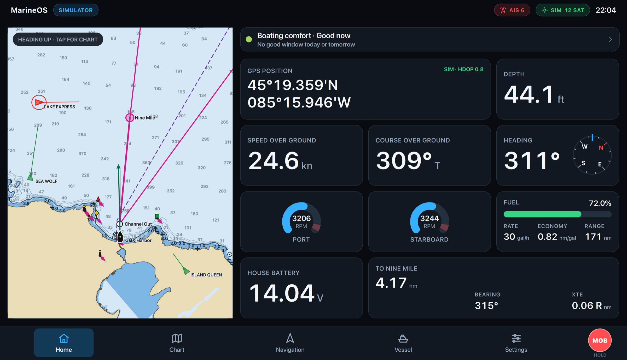
The MarineOS Home screen: chart, boating comfort, position, engines, fuel, battery and the next mark
MarineOS
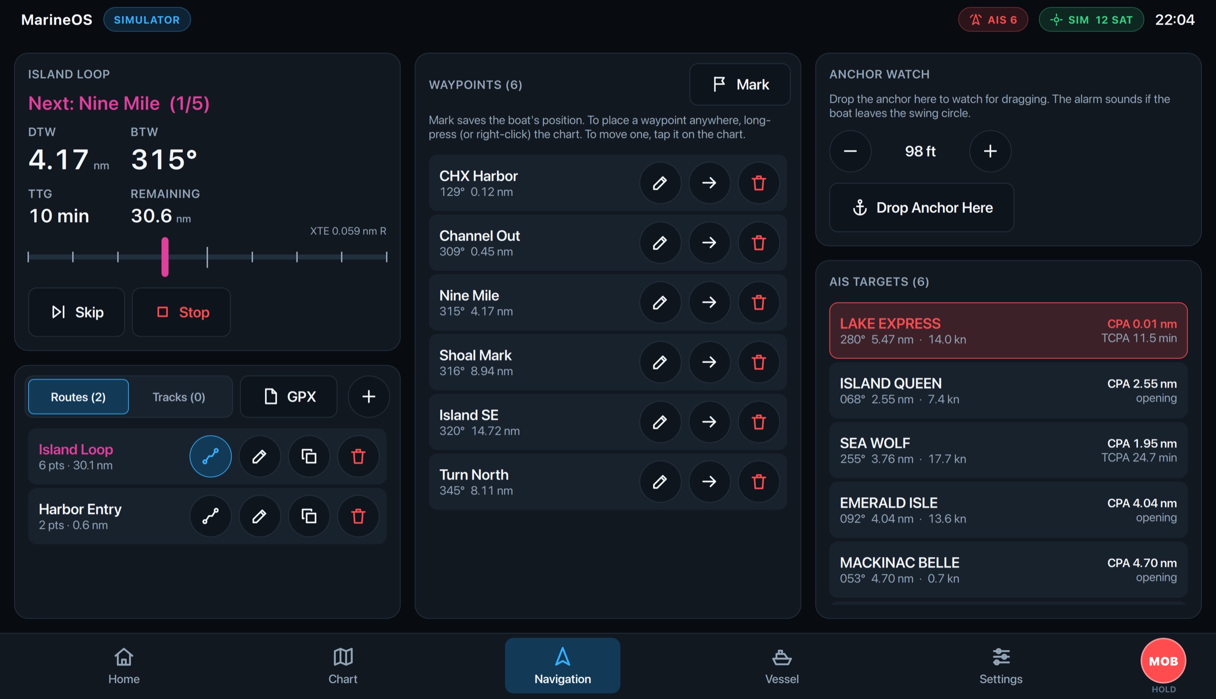
MarineOS Navigation: the active route, routes, waypoints, anchor watch and AIS targets
MarineOS
From one boat to a fleet

Built for one boat. Ready for twenty.

The same MarineOS that runs your boat runs a charter company's: every boat on one chart, everyone with the right access, and every display kept up to date from the Cloud.

Professional captains
Plan for the owner's boat, run it, and hand it back with its track.
Charter operators
Every boat on one map, its alarms and where it's headed.
Marinas
The boats you look after, together: where they are and which need you.
Fleet operators
Accounts, members and roles; software updates rolled out by channel.
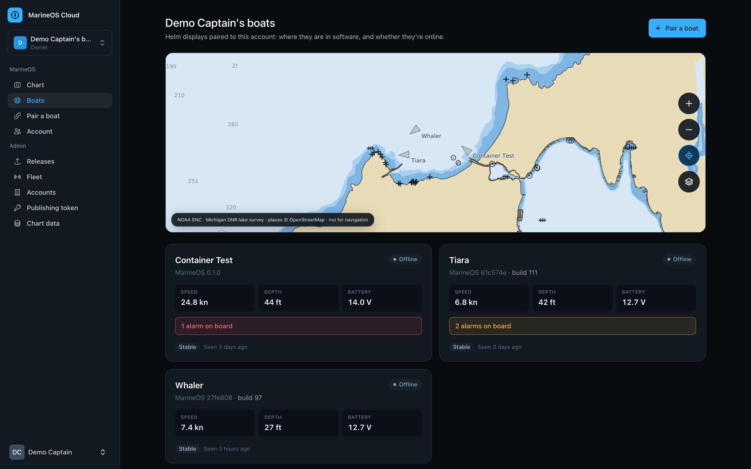
marineos.cloud/dashboard
MarineOS Cloud's dashboard: an account's boats on one chart, each with its speed, depth, battery and alarms

Put MarineOS on your boat.

Start with a free account and the chart in your browser. Pair your helm display or phone when you're ready.